Sunday, December 5, 2010

High water Colo trip


After a few days of fairly consistent rain, I was interested to see what the Colo was like in high water. I had two ideas.

One was to head up to the Culoul fire trail on the Putty road and drive, walk, and ride to the end point where there is a lookout that gives a great vantage point of the middle section of the Colo near Wollemi creek. The second was to revisit and potentially paddle the Upper Colo bridge back to the Putty bridge.

When I drove over the Putty bridge, I saw a fast flowing river which I just had to paddle!

I decided to drive up first to check what the river was doing as I had no idea what to expect. There was some local flooding here and there but as the Upper Colo gauge had peaked at 7.56m and had been dropping since the day before I wasn't concerned. As it turned out I ended up paddling it at 7.5m!


 The put in seemed ok so I drove back to the take out, dropped the car off and rode my bike back to the start. After the half hour ride I put in at 9.30am and started paddling. It was a fast flowing muddy brown conveyor belt which other than moving fairly fast seemed quite safe.


It only took one hour to do the 12k's back to the car and there was a fair amount of debris in the water. I took the raft out under the bridge and started the drive back up to pick up my bike.


Untitled from Dibble on Vimeo.


About 2k's up the road, I came around a bend to find a queue of cars banked up and a flooded road!
Wheeny creek bridge was completely submerged and only a couple of 4WD's were getting through. The locals were saying nobody would be getting through soon.


I parked the car and thought I'd wade over and walk the 10 k's to get my bike when a nice bloke from a 4WD club said he'd give me a lift as his club was camped up near the bridge anyway. We had a great chat about his recent 6000k trip through the Australian outback on the way and after thanking him, I found my bike and headed back.

On the way I started to worry that the water level may reach the car so after twenty minutes of riding I made it back to the bridge. The water had continued to rise so I waded back across with the bike. The water was up to my waist by now and had just reached my car on the other side.


I was relieved to get back just in time but as I was loading the bike in the car, a local told me the road was cut off behind me as well so I raced off to find another flooded section of road. I managed to drive through this one though as it was only up to the doors.


It was a great day out even with all the drama and I learnt quite a bit about this section of river and what heights I can access that side. The river hit 10.5 meters by Sunday morning.

Sunday, November 28, 2010

CANOE CREEK TO BOB TURNERS TRACK

I decided to head up to Canoe Creek for a paddle down to Bob Turners track on the Colo River after hearing it was a good two day trip. From what I'd read on the interwebz, most people do it on Lilo's but this trip sounded perfect for Packrafting.

Without an option for a car shuffle due to circumstance, I took my trusty all mountain steed for the 24 kilometre ride to the start of the walk in point. I arrived at the Bob Turner track to drop the car off and got under way at 6.30pm on friday night thinking I could easily cover the distance on the bike before dark. As usual things never go to plan.....

Literally two minutes from the car, my chain snapped. I had two options.... Walk or take the bike and roll down the hills which in theory would be twice as fast as walking but still slower than riding. This is the second chain I've snapped from riding with a heavy pack. So with thoughts of "You idiot", scrolling through my head, off I went pushing the bike up the hills.
I was able to "scooter" the bike on some of the flat sections and rolled down the hills somewhat slower than normal.

 I started to fatigue one leg from scootering and as it got dark, I pulled out the head torch and map and tried to keep track of the fire trails so I didn't miss the Grassy hill fire trail.
At 9.00pm on the dot I reached the trail after 15 k's and decided to head a further kilometer down and setup camp for the night.

I was fairly tired after a busy day at work plus the 15 or more k's so I set the alarm for 5.00am and crashed.
At 6.00am I was up, and ready to roll after eating and packing up. It took 1 hour to do the 6k's to the gate which marked the start of the Canoe creek trail so after stashing my bike in the bushes and chaining it to a tree it was off down the trail for a 2 k walk to the Colo river.


After a while the single track down into Canoe Creek proper started and the grade became fairly steep. My legs turned to jelly which had me wondering about my overall fitness and whether I was getting old.

There were remnants of broken kayak trolleys, lost wheels, and scrape marks from hauling canoes and kayaks down the steep gully. Just before the final drop to the Colo, a beautiful 180 degree view of the river spread out before me. It was an amazing vista of a spectacular gorge snaking it's way through some fairly remote wilderness in the Wollemi National Park.


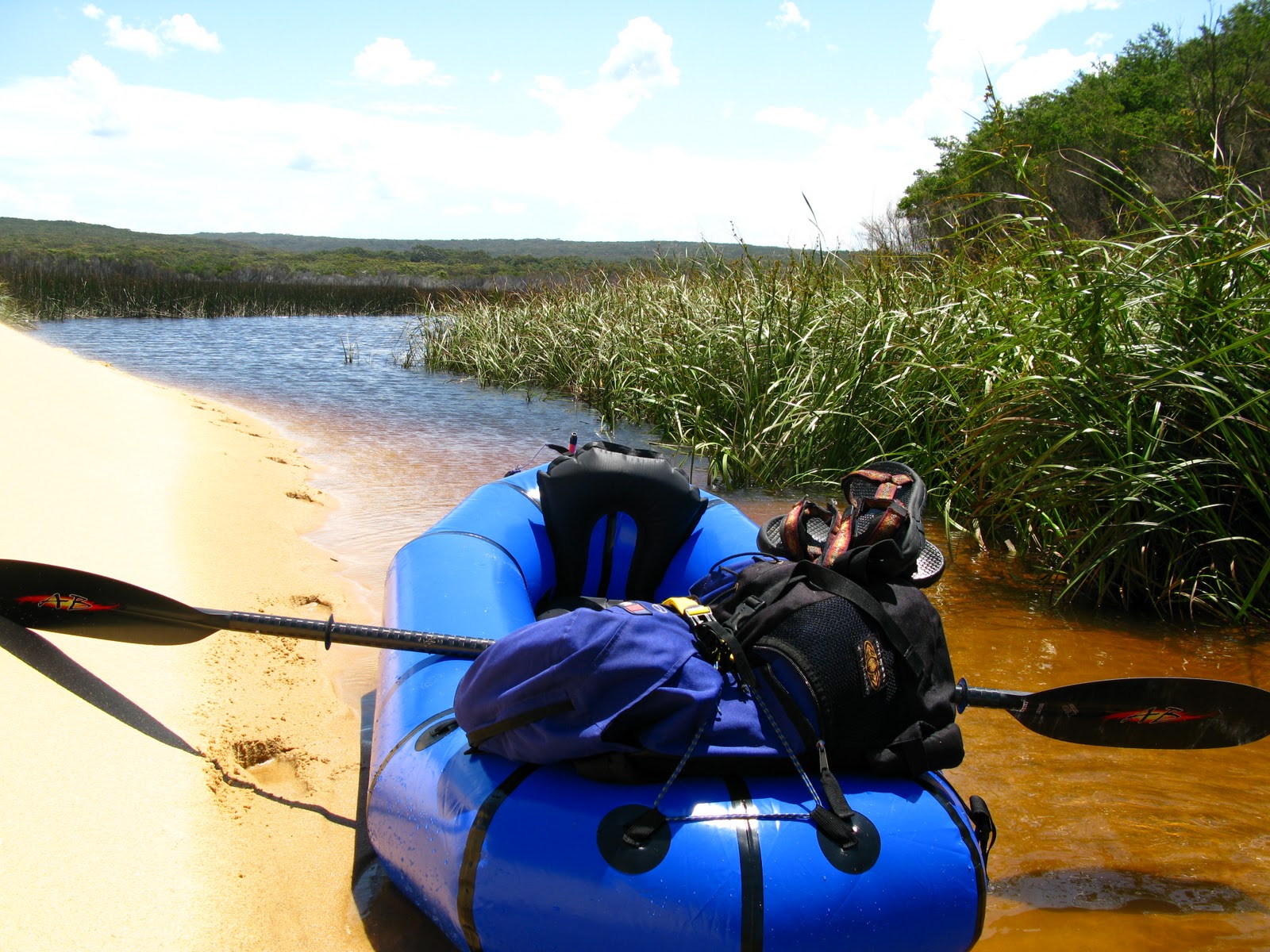
I arrived at the river at 8.30am after an hour and a half walk in. I wasn't sure what to expect of the river from a paddling perspective as I hadn't been up this far, but as the first rapid came into view excitement took over and I was into it.
The guide I had read said it was 20 kilometers of grade 2-3 with one grade 4 (King rapid) but as it hadn't rained for a week, I figured it couldn't be too bad. The first rapid came up pretty quick and I managed it with no problem, even with a two day load on the front.

The rapids could be scouted from the boat so I hit the second one fairly quickly. I came out and before I knew it was under water bouncing over boulders.....I came up without a paddle or a hold of the raft!

I managed to dive over to the raft and hold footing mid rapid searching desperately for any sight of the paddle...Nothing for 20 seconds..... then the boulders released their hold and out it shot from the cauldron upstream and I grabbed it as it came speeding past.

I was laughing at my inability to get down these relatively small rapids with out coming out.

As the day progressed though I realised with growing confidence that coming out of the boat was just part of the game and ended up in the drink three or four more times. I was truly having fun and thought what a great weekend away. Solitude in an amazing gorge, interspersed with a rush of adrenaline every so often.


I reached the junction with the Wollongambe river at 1.20pm and had a quick lunch of noodles and chocolate, washed down with the last of my drinkable water. I refilled and purified another two litres for later.
I realised that I was making great time and if I continued the pace I could actually make it out in one day. The river section was 20 k's and I had planned to camp again somewhere on the river but after checking the map I packed the gear and paddled on in the hope of getting back to the car.

The rapids after the Wollongambe seemed longer and more fun with only the odd scramble over rocks. I had one portage at the Grade 4 King rapid which almost looked doable. I will definitely give it a crack with more water. I could only see one potential problem spot near the bottom section which required a hard right to avoid a rock which may only need another 6 inches of water to get over and around it. Next time.....


Untitled from Dibble on Vimeo.

Towards the end of the day there was one fairly long flat water section and near some of the last rapids the carnage started to show with canoe's wrapped around boulders, rafts in trees and clothing strewn amongst debris from previous adventures.


At 4.40pm I arrived at the Bob Turners track exit in time to be offered a cup of tea by a couple who had a great camp by the river. I respectfully declined as I still had to walk an hour back to the car and then drive back up to pick up my broken Bike.

Another hour's walk back to the car after a solid 8 hours of non stop paddling, I was fairly buggered. Over 45 kilometers in under 24 hours. Not a record but definitely an adventure for sure.....

Sunday, November 14, 2010

Marley Lagoon

Dana and I decided to go and do some exploring of Marley Lagoon after looking across the dunes on a previous walk and wondering what we might find on her distant shoreline. Its a very small body of water behind Marley beach which I know little about.


The memory I had from the last visit was of an easily accessible, tannin colored and seemingly clean Lagoon. Upon arrival it appeared much the same with the exception of some new plant growth which blocked entry to the main waterway, but we were confident of breaking through.

I had a quick look on Google Earth the night before and it seemed to show a small secluded beach on the far side, although all we could see from the dunes were reeds. We took the Little Marley fire trail in from Bundeena Drive which took about an hour and a half, branching off towards the coast at any junctions.


View Larger Map

This Trig point was located just near the fire trail start point.


This small delicate flower was scattered along the sides of the track.  

It was 33 degrees and there was nowhere to hide from the sun on the walk in.


 This section of coastline is quite spectacular, and there were many people doing the two day Coast Track.


After a while we came to Little Marley beach which is a popular fishing spot off the rocks.


Once we arrived at Marley beach, it was time to head into the small dune area and over to the Lagoon for some exploring.


I'm fascinated by this pinnacle of sand at the back of the dune system. It reminds me of the Sentinel in Kosciusko National Park.


It was good to be carrying a relatively small light load for a change.


I was keen to get the Packraft out and inflated upon arriving although the plants which I think are a type of Pampas grass, (possibly Cortaderia selloana) seemed to block access to the larger area.

We had some lunch and found a suitable launching area and off we went.

With only one packraft and two people we decided to sit facing each other. I wouldn't do this with my mates unless I had to......

After 10 minutes of difficulty we made the short 20 feet through the Pampas grass which was incredibly sharp. It was a million razor blades scraping and scratching on the sides of the Llama which had us both pretty nervous.

Dana found the ride very relaxing and almost nodded off to sleep after a busy week.


There were schools of fish jumping out of the water here and there, and although I'm not much of a fisherman they seemed to be some kind of Mullet about 40cm long. One almost landed in the raft giving us a bit of a laugh.


....and doing some......testing.

We didn't find any small secluded beach on the other side but it was a nice day out none the less.